Bevois Mount
The Mystery of the Mount
ACCORDING TO LEGEND Bevois Mount was either a burial mound containing the tomb of Sir Bevois or a fortification built by the Saxons under his command. According to some versions he fought against the Danes and according to others he fought against the Normans and was defeated by them “in the battell at Cardiff in Wales”.
|
More mundane sources indicate that the Mount may predate both the Danes and the Saxons. John Speed in his History of Southampton tells of an oral tradition that Roman coins had been found on top of “Bevois Hill”. He goes on to say “the side of the Hill next the Shoar is very steep and has a wet Ditch at the bottom of it”. He proposes that the hill may have been a scouting outpost for the Roman settlement at Clausentum. A description of the town in the Fletchers’ Street Directory surmises that there were two outposts, one being Northam and the other being Bevois Mount “at both of which places Roman coins have been found”.
|
1827 print of Bevois Hill.
|
In Characteristic Survivals of the Celts in Hants (1891), T.W. Shore proposes an even earlier origin: “The passage of the Itchen was strongly guarded by an earthwork strongly placed on a river cliff known as Rockdone, and later as Bevois Mount, destroyed since the beginning of this century”. The destruction referred to involved quarrying, which is discussed below.
There is a compelling argument that the prime purpose of the Mount was defensive, whenever it was built, because of the importance of the Itchen as a route to the hinterland and for the Romans to Venta (Winchester). The fact that this bend in the river was probably fordable at one time makes it of even more strategic value.
There is a compelling argument that the prime purpose of the Mount was defensive, whenever it was built, because of the importance of the Itchen as a route to the hinterland and for the Romans to Venta (Winchester). The fact that this bend in the river was probably fordable at one time makes it of even more strategic value.
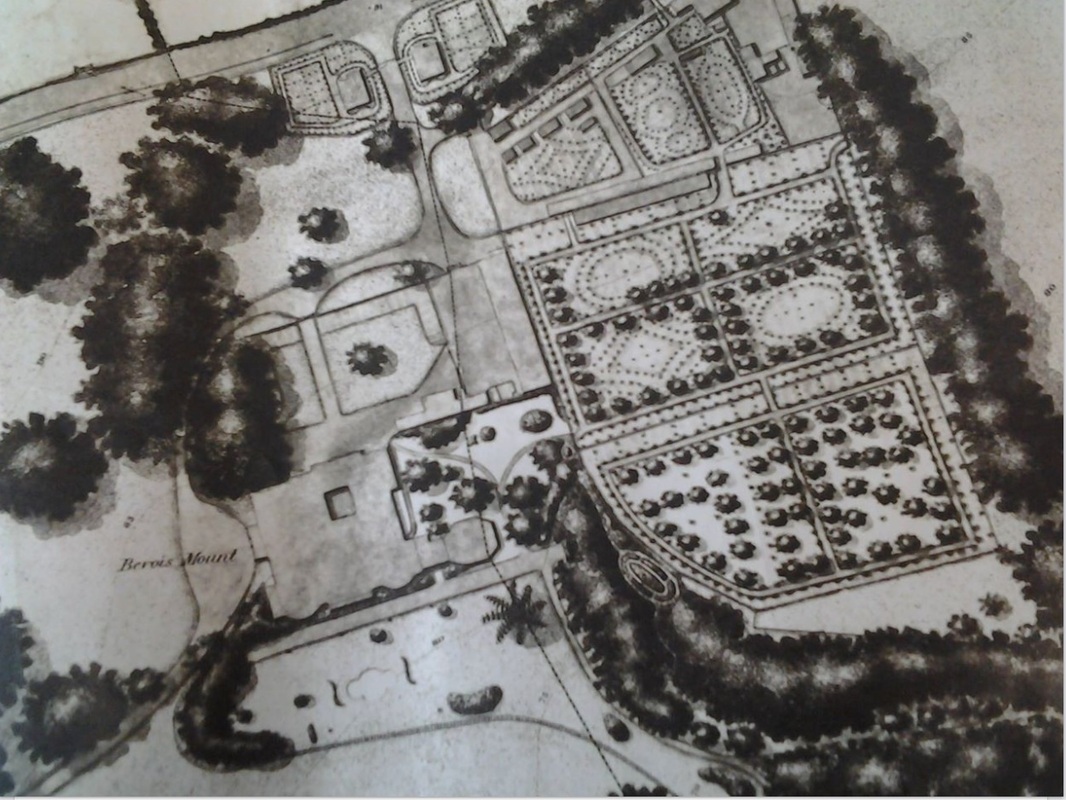
The gardens around Bevois Mount House
|
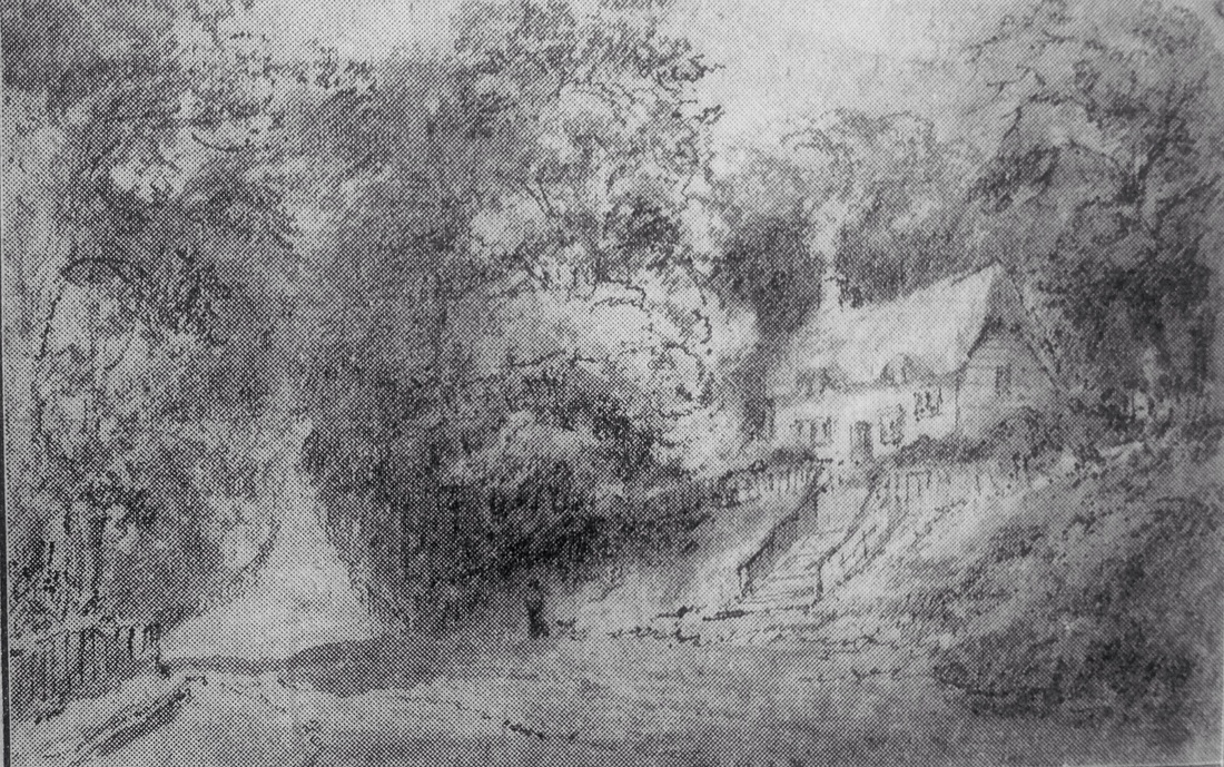
Paths from the house leading to the Mount on the right of the image
|
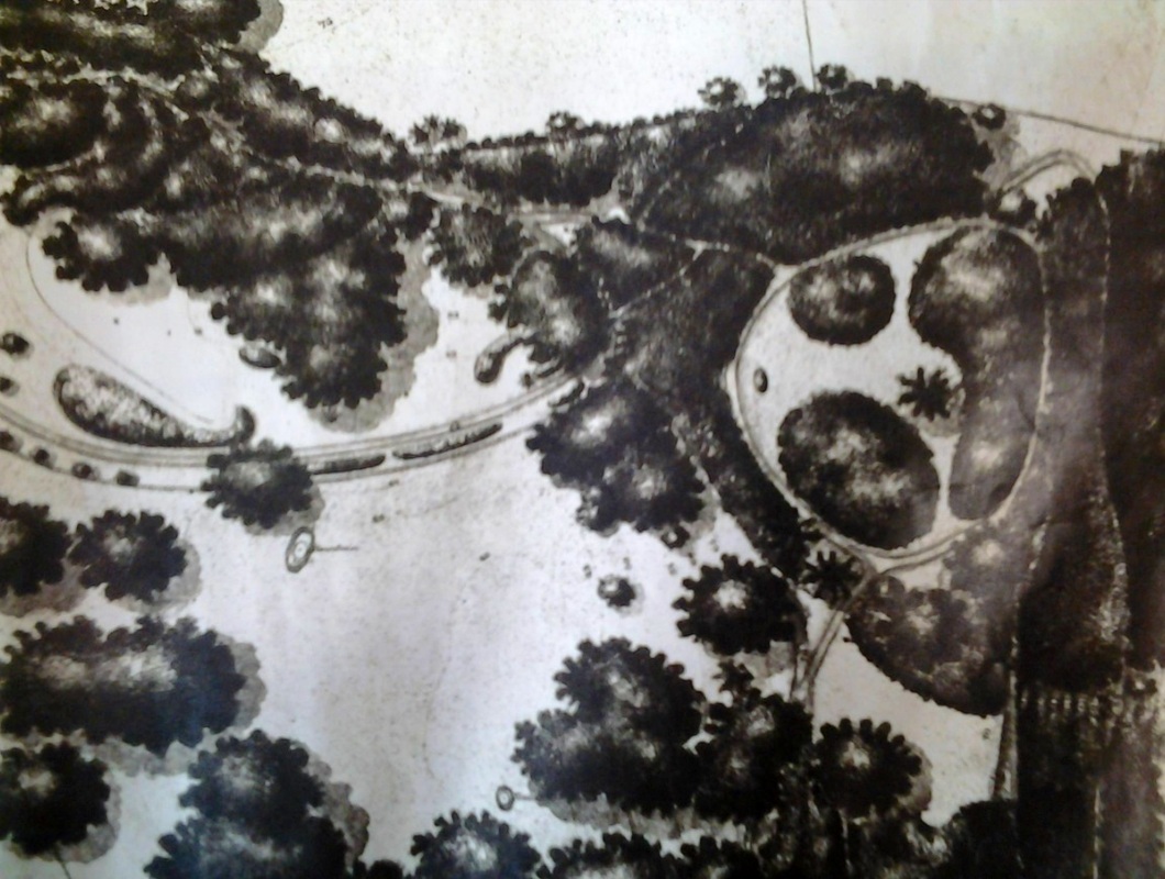
What we can be certain of is that when the Mount became part of the estate of the Earl of Peterborough in 1723, it was made an important feature of “the beautiful gardens” of which he was so proud. He preferred to show guests round the estate when the tide was high so that they could best appreciate the view across the Itchen from the Mount. A visitor to Bevois Mount in 1753 talks of various walks, labyrinths, a parterre, a small vineyard and a summerhouse. Speed makes reference to the building of this summerhouse and says that a barrow had to be removed in order to dig the foundations and in the process of this human remains were discovered. It is possible that while the fortification was built to defend the estuary, a barrow may have been placed on its summit.
The most conclusive evidence we have as to the size and shape of the mount is the Ordinance Survey map of 1846. Although there are no contour lines, tiny white figures to the south-west show that the ground rose steeply from 26 feet to 70 feet above sea level at this point, confirming Speed’s description. It seems likely that an artificial mound was constructed on a spur of naturally high ground. As there are no figures given for the top of the mount, it would be safe to assume that it was flat at this time. The summer house apparently had not survived, as it is not shown.
The most conclusive evidence we have as to the size and shape of the mount is the Ordinance Survey map of 1846. Although there are no contour lines, tiny white figures to the south-west show that the ground rose steeply from 26 feet to 70 feet above sea level at this point, confirming Speed’s description. It seems likely that an artificial mound was constructed on a spur of naturally high ground. As there are no figures given for the top of the mount, it would be safe to assume that it was flat at this time. The summer house apparently had not survived, as it is not shown.
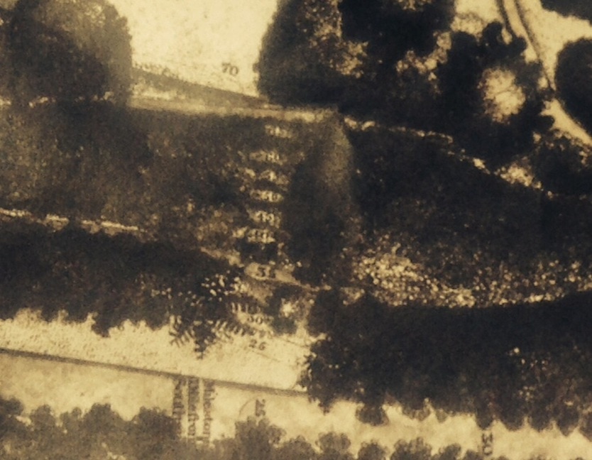
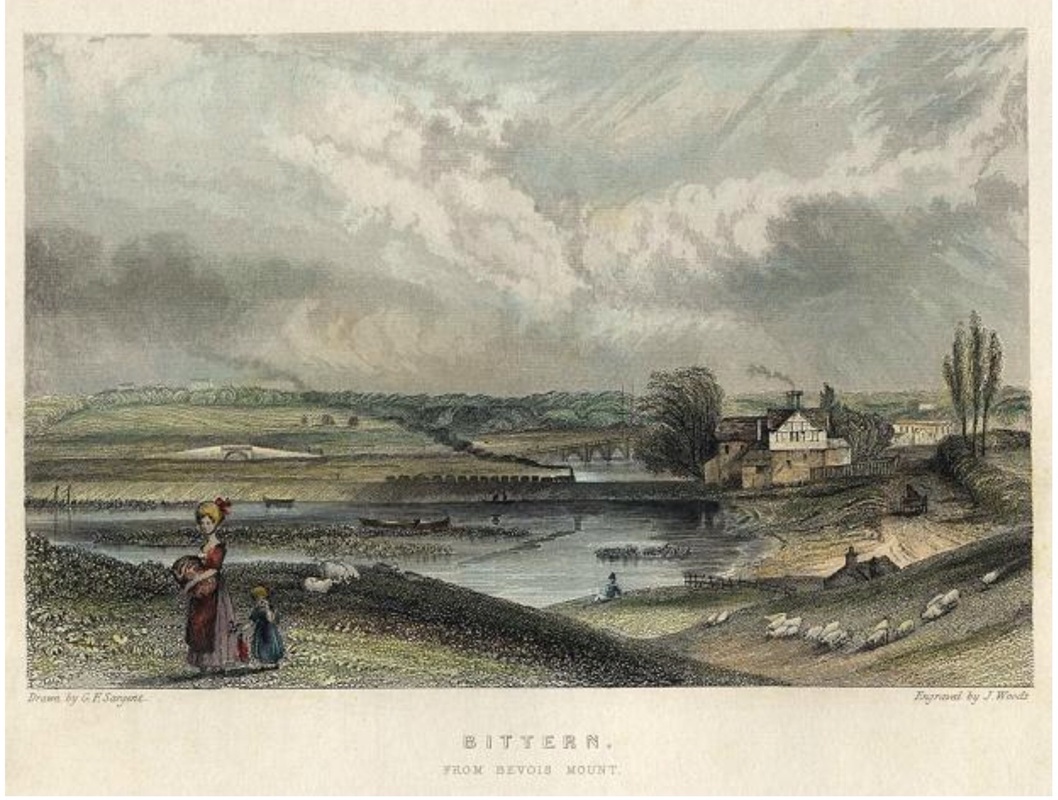
The image above shows the values of the height above sea level. The number 26 is on the equivilant of Bevois Valley Road and increases in steps of five feet to the top where number 70 can be seen. The 70 would be roughly where the artist stood to paint Bittern from Bevois Mount by G.F. Sargent above.
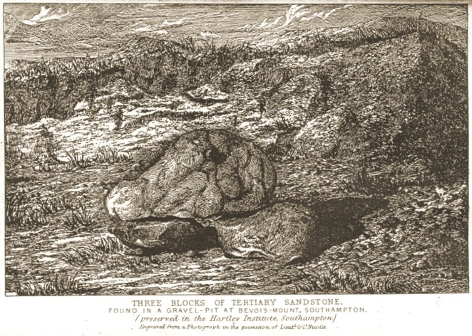
Illustration of the Gravel pit from quarrying at Bevois Mount
When the estate began to be sold off in the mid 19th century, the artificial mound and the rock beneath it were a source of building material and therefore remorselessly quarried in order to build the houses and roads that we have today. Unfortunately so little of it now remains that the date and purpose of Bevois Mount will always be a mystery – and perhaps it was erected by our Southampton hero after all.
The mysterious ‘tomb of Sir Bevois’ from a drawing by T.G. Hart
Allyson Hayes
© Bevois Mount History.
© Bevois Mount History.
