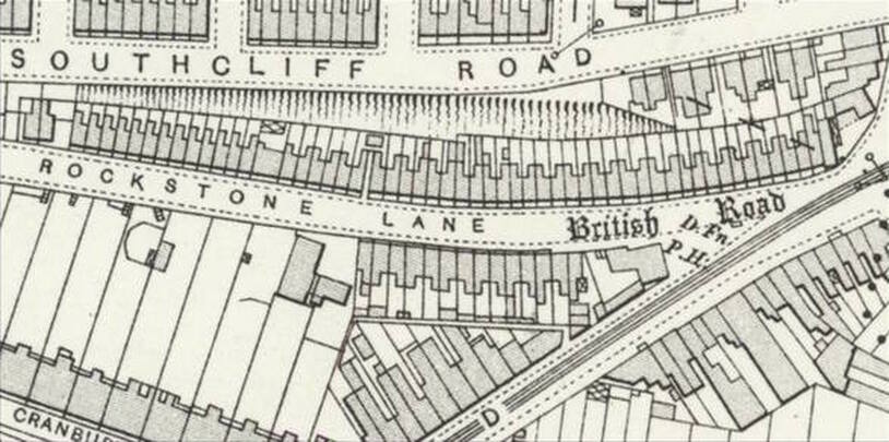
Rockstone Lane
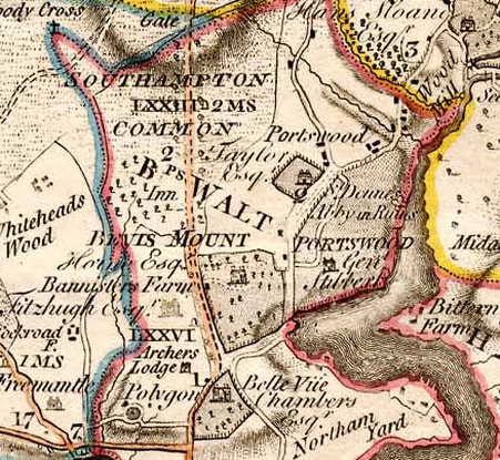 Milne map of Southampton 1791
There is a turning off a major thoroughfare, not far from the centre of the city, which is a pocket of charm and heritage. The rows of small cottages would not look out of place in a country village or a small coastal resort.
Rockstone Lane was originally a natural gulley or stream bed. In about 1800 Sir Henry Englefield referred to it as a ‘deep and romantic hollow’. People who live in the cottages will be very aware of this because their gardens rise very steeply at the rear. The road at the top was originally named Cliff Road (now Southcliff Road) for good reason. There is a document which refers to a small hamlet called ‘Rokesdene’, in the vicinity, in the thirteenth century. The ‘dene’ part of the name probably signifies ‘dell’. As late as 1844, the large field abutting the lane, part of the Bevois Mount Estate, was known as Rooks Down, offering an alternative origin for the contemporary name.
Strange as it may seem, for a long time, when the Avenue was just a track across the Common, Rockstone Lane was the main road from the town of Southampton to London and Portsmouth. Coaches would leave, from The Dolphin or the Star, perhaps pausing at the Padwell Pond for refreshment for the horses, and then head down the lane, through the valley, up into Portswood and on to the east. This was the situation until the Avenue became a Turnpike Road in 1758.
The Earl of Peterborough must have arrived in Southampton via this route when he first spotted the mount and the adjoining land from which he later created his estate. Professor F.J.C. Hearnshaw, writing about the Bevis (sic) Mount Estate, said, “There are people still living who can remember the time when the hedge and ditch which bounded the estate on its westward side stretched along the Avenue from the back of the present Westwood Road to Rockstone Lane, and when Rockstone Lane itself, the great high road to Portsmouth, was rich in the beauty of grassy banks and overhanging trees and distant views pf river and wood”.
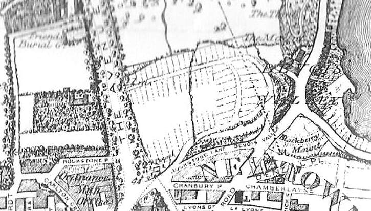
Philip Brannon map 1850
A later owner of the estate, Samuel Betts, built the much-mourned Stag Gates. Subsequently his affairs became ‘somewhat involved’ as Hearnshaw described it and he was forced to sell off much of the estate to a syndicate. And so, the building began. The artisan cottages of Rockstone Lane were among the first to be built. One proudly displays 1850, the date of building on the front and the others are, no doubt, of around the same vintage.
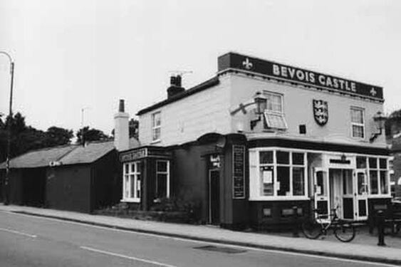
The pub, on its wedge-shaped piece of land, helps to complete the villagey feel of this small area. Originally called the Bevois Inn and for many years, the Bevois Castle, it dates from 1843 when it was leased to Eldridge Pope’s Dorchester Brewery. A finishing touch is the old horse trough and drinking fountain designed and made by Garrett and Haysom. It was the gift of two benevolent ladies who wished to remain anonymous and the inscription reads, “God made all the creatures and gave them all our love and our fear. To give sign we are His children, one family here”. This fountain is now a Grade II Listed Building.
The pub, on its wedge-shaped piece of land, helps to complete the villagey feel of this small area. Originally called the Bevois Inn and for many years, the Bevois Castle, it dates from 1843 when it was leased to Eldridge Pope’s Dorchester Brewery. A finishing touch is the old horse trough and drinking fountain designed and made by Garrett and Haysom. It was the gift of two benevolent ladies who wished to remain anonymous and the inscription reads, “God made all the creatures and gave them all our love and our fear. To give sign we are His children, one family here”. This fountain is now a Grade II Listed Building.
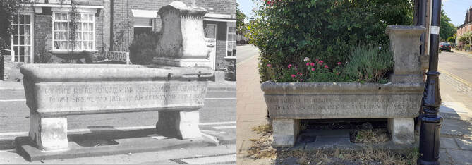
Old and recent photos of the Grade II Listed fountain
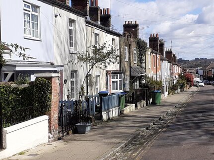
This small corner of the city has remained virtually untouched for close on a century and a half; even Hitler’s bombs made only a slight dent in its composure and damage to two cottages at the lower end was repaired in replica.
Unfortunately, now the nature and atmosphere of this oasis is threatened by a planning application for a building which will be totally out of character for the area. The proposal is to demolish a corn merchant’s, built in mellow red brick and dating from circa 1907, and replace it with a block of 13 modern flats.
Hopefully, the planning department will agree that converting a building into a block of thirteen flats will cast an irrevocable blight over this picturesque lane.
